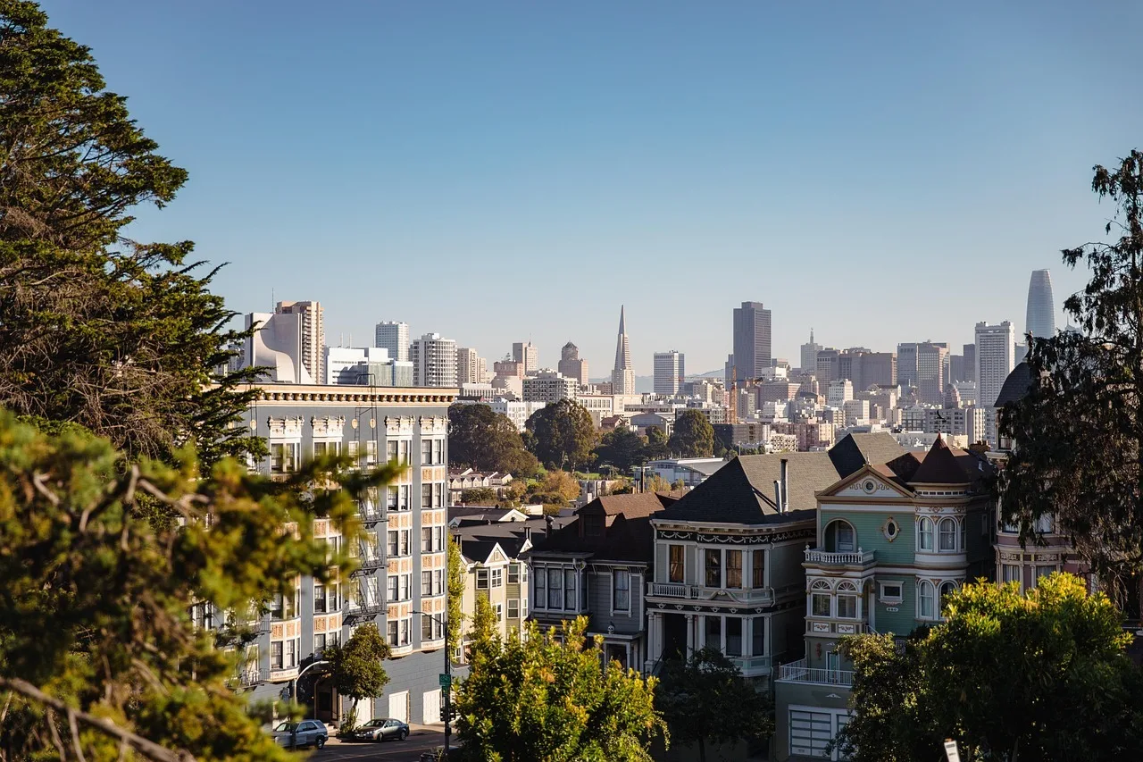
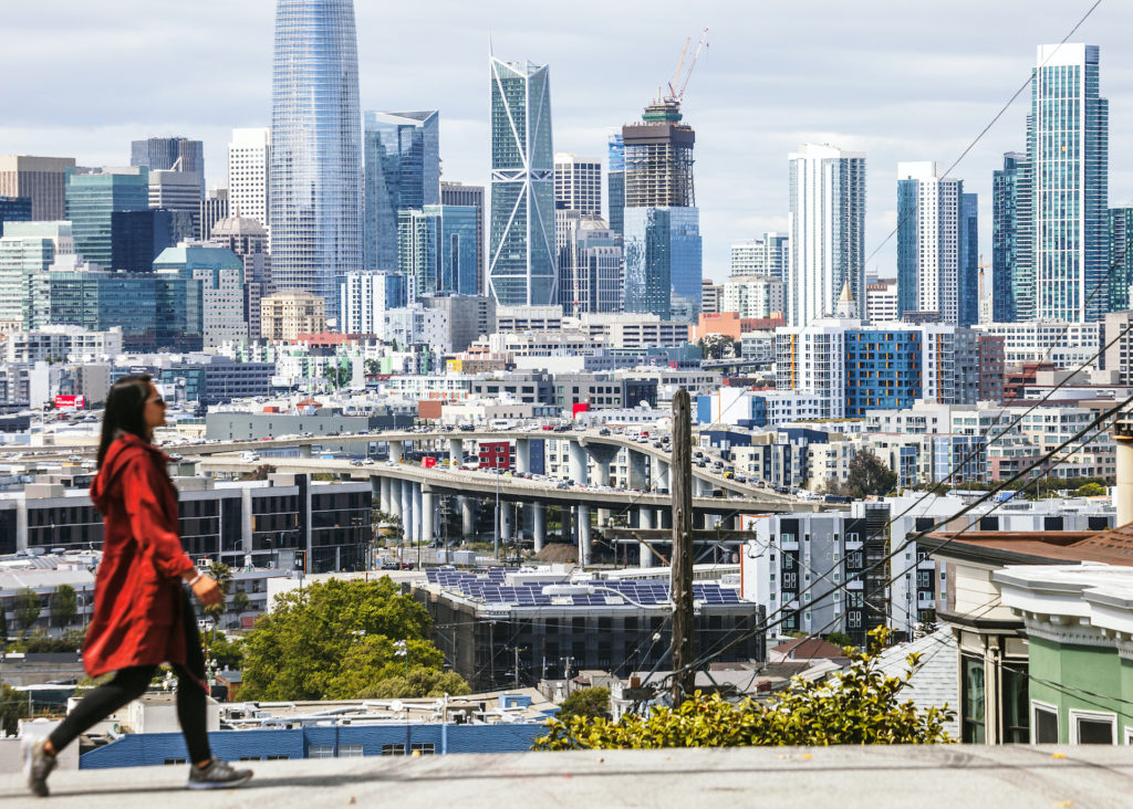
Between BART, Muni, and Lyft, there’s no need for a car in San Francisco—which is great since traffic and parking are a pain. Luckily, SF is quite traversable–the whole city is only 50 square miles. Drive five hours in any direction and you could end up sipping wine in Napa, hitting the slopes in Tahoe, or soaking up the sun on some beach in SoCal. No wonder so many people are moving here! If you’re one of them, read on for a complete guide to getting around.
Airports
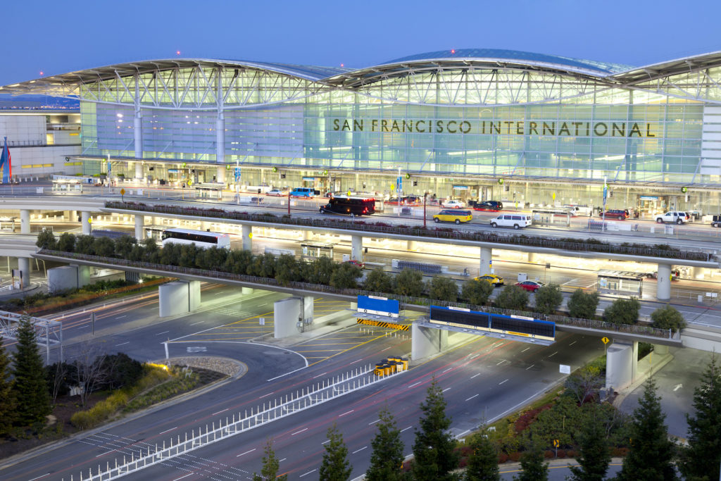
San Francisco International Airport (SFO): This major international airport is the busiest in the Bay Area, serving as a hub to United and Alaska Airlines. SFO is conveniently located off the 101 freeway, just south of the city. Travelers can take BART into the city or to the nearby Millbrae stop to transfer to Caltrain.
San Jose International Airport (SJC): San Jose serves as a focus city for Southwest Airlines and Alaska Airlines. Located about an hour southeast of SF, San Jose is more practical if you’re headed to other Silicon Valley cities like Sunnyvale, Santa Clara, or Palo Alto.
Oakland Internation Airport (OAK): If for some reason it’s cheaper to fly into the East Bay, you can always take BART into the city from this Southwest Airlines hub.
Train/Subway
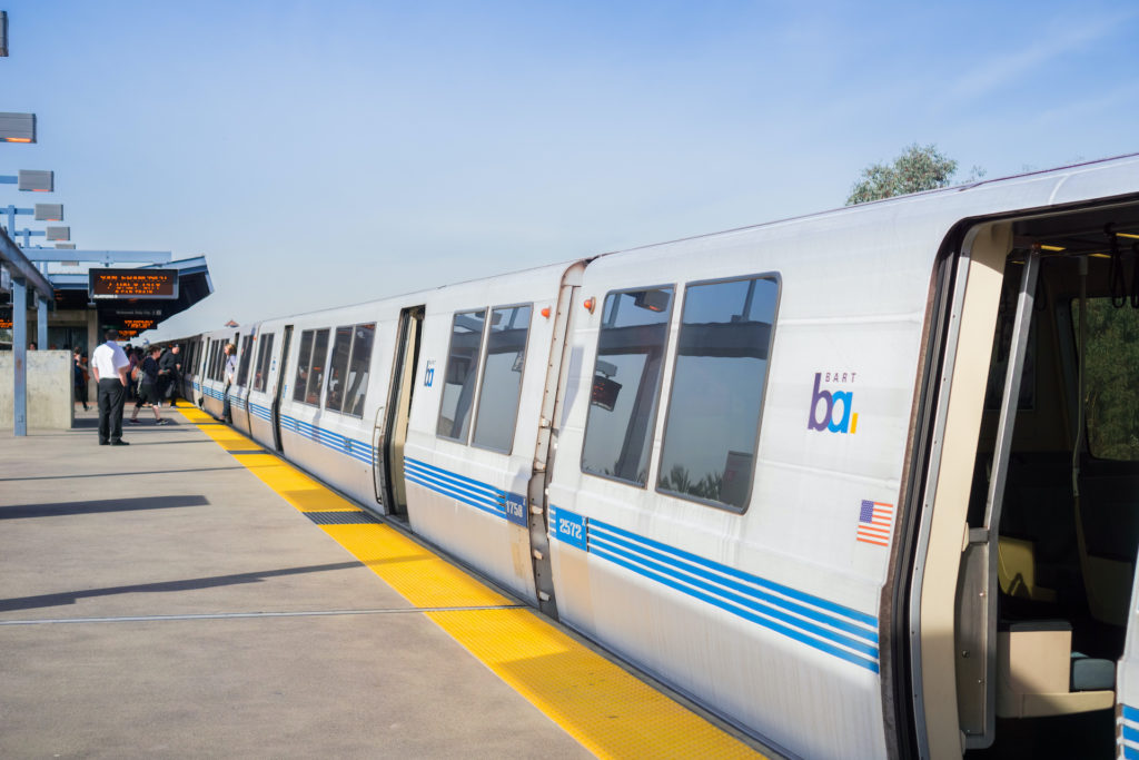
BART
Unlike some parts of California, the Bay Area’s public transportation system is on point. BART stands for Bay Area Rapid Transit, which is an expansive network of trains that makes eight stops in the city, carving a northeastern path through SF before heading to Oakland and throughout the East Bay. The subway system also serves as a commuter rail service to Contra Costa County, Alameda County, San Mateo County, and Santa Clara County.
BART fares are based on distance traveled—the greater the distance, the higher the fare. To estimate a fare, use the ticket calculator. As of June 2020, BART only accepts reloadable Clipper cards, which are for sale at BART station vending machines. Clipper can also be used with several other area transit agencies, including Muni, Caltrain, and SamTrans.
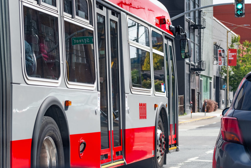
Muni
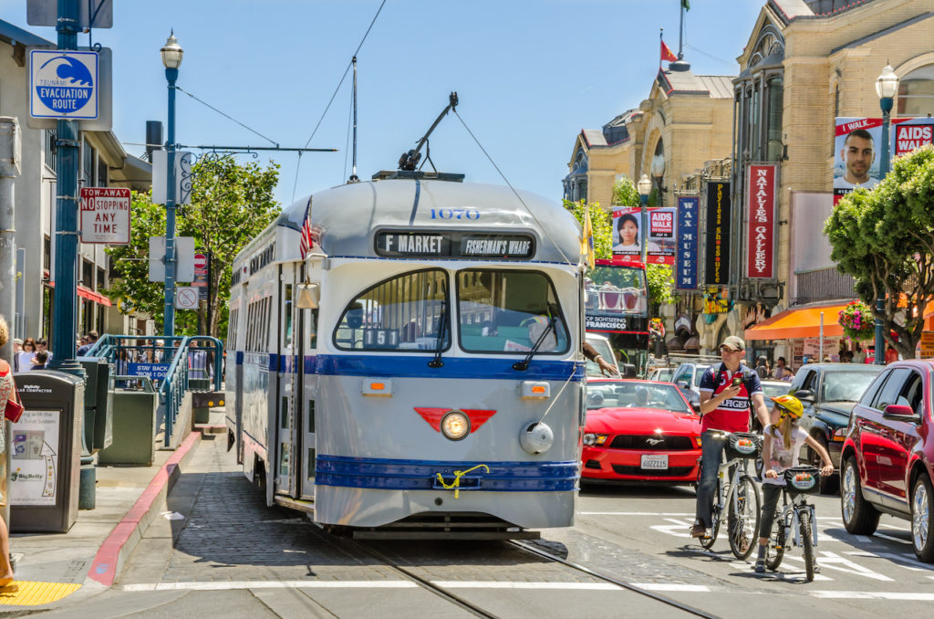
Muni, which is short for San Francisco Municipal Transportation Agency (SFMTA), is the city’s network of fuel-efficient buses, light rail Metro trains, iconic cable cars, and the historic F-line streetcar. The Muni Metro is a light rail/streetcar hybrid system made up of seven lines that connect the eastern side of the city with the southwestern portion.
Locate the nearest Muni Metro stop using the Metro Map, then use the Trip Planner to find your way. Four of the stations have opportunities to transfer to BART, while the 4th and King station has access to the commuter train, Caltrain. Many stops are located on a concrete island in the middle of the street, while those closer to, and in, downtown are underground stations.
All Muni fares, including bus, rail, and cable car can be paid with the MuniMobile app, the Clipper card, or with a Limited Use Ticket, which can be purchased with cash or card from a vending machine at the stations. At the time of this writing, a single, one-way fare is $2.50, or $3.00 if you’re buying a ticket at the station. Transferring from BART, Caltrain (Zone 1), Sam Trans, or other area agencies will get you a .50 cent discount. Plan on taking Muni and/or BART quite often? Spring for a monthly pass.
Commuter Trains
Caltrain
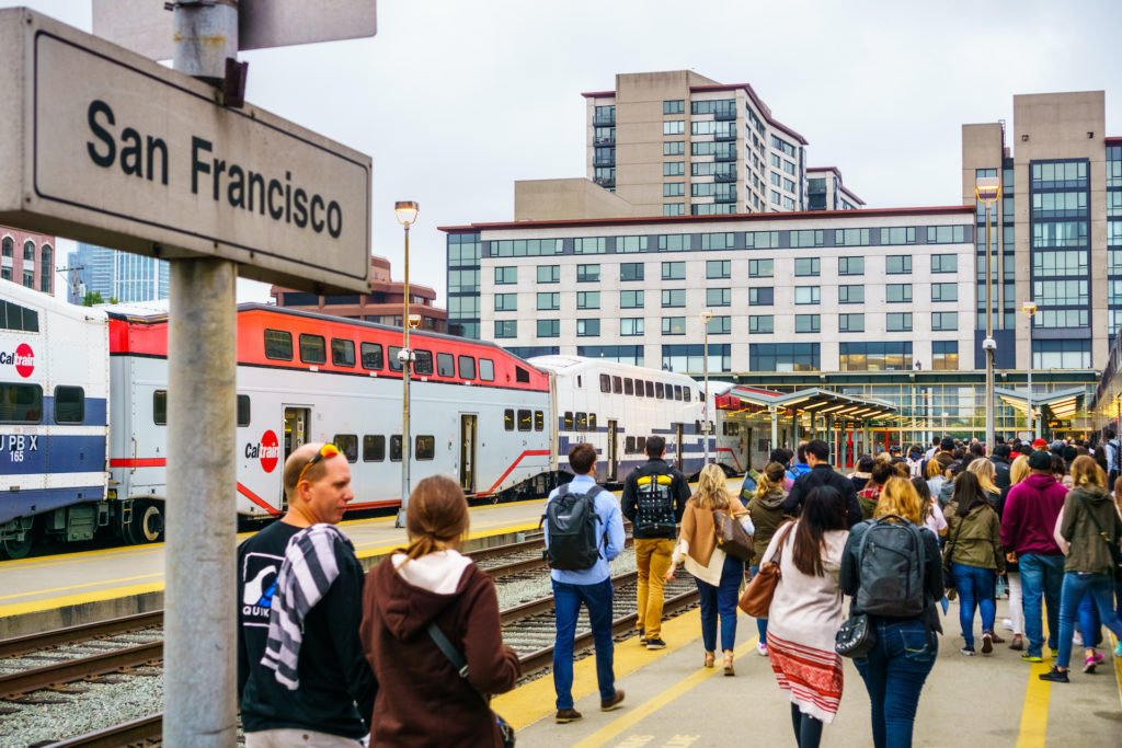
Working outside the city will require you to drive or take Caltrain. The commuter rail line, which runs from San Francisco through the Peninsula down to San Jose and the South Bay, is a good option if you live near one of two SF stations and don’t want to brave the infamous Bay Area traffic. Caltrain’s 4th & King terminal in the city is easily accessible by Muni’s 10 and 47 buses, the 45 trolleybus, and the N or T Muni Metro lines. Caltrain connects with bus and rail routes at certain stations.
During peak commute, Caltrain operates three trains per hour in each direction; Limited A, Limited B, and Local. Trains ending in 5 are Limited A, trains ending in 7 are Limited B. Fares are based on how many “zones” you go through. Purchase a ticket at the station, buy a one way, day pass, zone upgrades, and daily parking on the Caltrain Mobile app, or use your Clipper card. Caltrain and Muni also offer commuter shuttle programs.
Buses
Muni bus stops are everywhere—some are small shelters, while others are indicated by yellow paint on a street pole or white paint on the street. Find one using your own two eyes, the Muni system map, or the 511 SF Bay Transit Trip Planner app, which provides maps, routes, and times.
Local lines stop every block, while limited-stop lines usually stop every three or four blocks. Express lines shuffle commuters to and from the Financial District and the outskirts of town during peak hours only, while Owl service runs every half hour all night long from 1am to 5am. Check Muni Alerts or the NextBus app for complete schedules and estimate arrival times, which are also posted at most stops.
Whether you pay your fare through the MuniMobile app, via Clipper card, or with exact change, hang on to your proof of payment, which can be used as a transfer for two hours from purchase.
Golden Gate Transit is the bus system for Marin and Sonoma counties. SamTrans buses Bay Area folks from San Mateo County to San Francisco and parts of Palo Alto. Tons of tech bros staring down at their devices can be spotted sitting in traffic on the 101-S, shuttling their way to Silicon Valley.
Greyhound
Get on the Greyhound at Salesforce Transit Center and end up in SoCal cities like LA and San Diego; the state’s capital, Sacramento; or, go gambling in Vegas or Reno. Conveniently located on Mission Street, just a couple of blocks away from the BART station, the former Transbay Terminal also facilitates Muni, Amtrak, and more. Head up to the rooftop to check out the public park. Surrounded by skyscrapers, the rooftop park features a fountain, playground, and walking trail.
Car
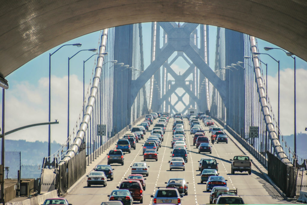
As the eighth most congested city in the US, traffic in and around SF is notoriously terrible. City officials combat this with their transit first policy, which focuses on transportation issues such as curb equity and Spare the Air Alerts that keep an eye on smog (so NorCal doesn’t end up like LA). Avoid highways like the 101, the 1, I-80, or I-280 during rush hour if at all possible.
Better yet, sell your car and use the money you’d spend on insurance, parking tickets, and gas on rent and Lyfts because finding parking in the city is like winning the lottery. Apps like Parking Panda and SpotHero can help you find a spot. Just remember to curb your wheels when parallel parking on a hill!
Get a FasTrak pass so you don’t have to remember cash and/or stop to pay if you plan on going across the Golden Gate Bridge to the North Bay or taking the Bay Bridge the East Bay quite often.
Cable Cars, Rideshare, and Car-Share
Head downtown to ride a cable car, but catch one en route instead of waiting in line with the tourists. Just pay the conductor (with exact change) or get tickets on the MuniMobile app. Rideshare stalwarts like Lyft and Uber are joined by Summon, Flywheel, and bazillion others in Beta, but you can still hail a cab the old-fashioned way. Car-share apps such as Zipcar, Getaround, and GIG Car Share help the city maintain curb equity. There’s even moped sharing!
Walking
San Francisco’s temperate climate and the fact that it’s only seven miles across would lead one to believe that you could traverse the city from one end to the other. In theory, that’s possible, but in practice, the hills would wear you out. Streets like Divisadero and Fillmore have a staircase for a sidewalk to help navigate their steep inclines.
If you ever get lost, just find your way to Market Street. The major thoroughfare starts at the northeastern edge of the city in front of the Ferry Building in the Embarcadero and runs southwest through downtown, past the Civic Center and the Castro District.
Alternative transportation
Bikes and scooters
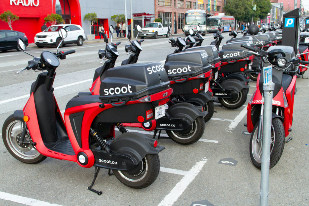
San Francisco’s bike lanes, routes, and paths make it easy to get around on two wheels. In addition to the city’s own bike-share network, CityRide, Lyft, Uber, Lime, and Spin offers bikes and e-bikes in the Bay Area. Bike or walk around the San Francisco Bay Trail, which will eventually go around the entire shoreline of San Francisco Bay. All major train and bus operators allow bicycles onto their systems. Scoot around on electric scooters from Uber, Spin, Lime, Skip, and Scoot.
Ferry
See the city from the water on the Golden Gate Ferry, Blue & Gold Fleet, ou Red & White Fleet ferries. Take the ferry to Oakland, Marin, Sausalito, and other surrounding Bay Area cities.
Commuting in popular neighborhoods
Pick your place based on your commute from work and find out which Muni routes serve your area. Here are some transportation pros and cons in the city’s top neighborhoods.
Haight-Ashbury: Muni is your BFF in the Haight. The 6 and 7 bus run up and down Haight Street, connecting the area to downtown. There aren’t any BART (Bay Area Rapid Transit) stations in the neighborhood. Luckily, ever-walkable Haight Street has everything you need, from breweries and trendy coffee shops to late-night pizza joints and sushi restaurants.
Outer Sunset: Known for its proximity to Ocean Beach and the western half of Golden Gate Park, Outer Sunset is served well by Muni, particularly the Judah-N line.
Glen Park: Located south of Twin Peaks and adjacent to Glen Canyon Park, Glen Park has it’s very own BART station, making it an attractive neighborhood for commuters and residents looking for a short ride into the city.
Outer Mission/Excelsior: Bus lines run up and down Mission Street, which forms the border between the Outer Mission and Excelsior. Balboa Park BART Station is just a few blocks outside the neighborhood boundaries.
The Marina: The Marina is served by multiple Muni bus routes, but if your commute requires a car, this is probably not the place for you. This ‘hood is situated at the very northern tip of the city, so getting in and out of San Francisco can be a headache.
Hayes Valley: Located in the Western Addition, Hayes Valley is home to several Muni bus stops. Civic Center (aka UN Plaza Station) is the closest BART and MUNI station.
The Mission District: Many Muni bus routes serve this popular area, while BART delivers good, fast service between the Mission District and downtown San Francisco. Find BART stations at 24th & Mission as well as 16th & Mission.
Ready to get your wheels spinning and move to San Francisco? Search thousands of San Francisco apartments for rent on Zumper and find your new home.
Contenu associé