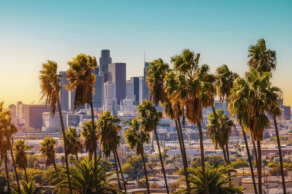
Encompassing over 500 square miles, Los Angeles is the largest city in California. Navigating LA transportation is essential to effectively exploring, commuting, and living in the City of Angels. From automobiles to public transportation, it can be hard to choose the best route and mode of transportation to get where you need to go. To simplify your commute, we’ve outlined a full guide to Los Angles transportation.
Traveling in Los Angeles by car
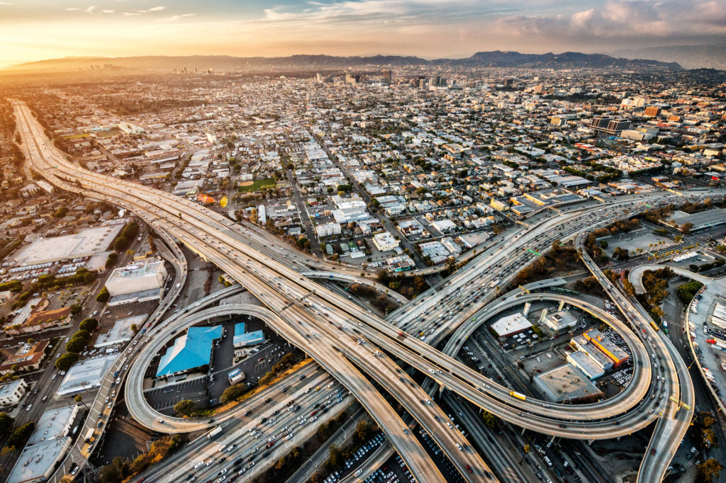
Whatever you do, don’t underestimate traffic. With nearly four million residents, you can see why LA’s notoriously terrible traffic jams are legendary. Unexpected congestion and pile-ups on the freeway can make what should be a 30-minute trip take two hours. A dozen major freeways crisscross the region, and although they are marked with numbers, portions of them are referred to by name instead. Another quirky thing Angelenos do is saying “the” in front of the highway number, like “The 101”. State Route 1 is known as “The 1,” but it’s also called Pacific Coast Highway. Interstate 10 goes west to Santa Monica and east to Phoenix, AZ. “The 5,” or Interstate 5, goes up through the Central Valley to Sacramento and south through San Diego to Tijuana in Baja California, Mexico. “The 101,” US Route 101, heads up the central coast to Santa Barbara and on to San Francisco.
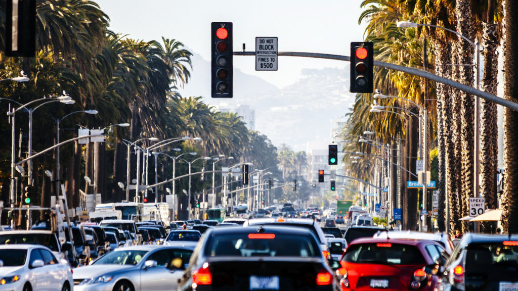
Get to know surface streets so you can avoid congested freeway traffic during rush hour. Major east/west routes include Ventura, Hollywood, Sunset, Santa Monica, Beverly, Wilshire, Olympic, and Venice. Major north/south routes include Topanga Canyon, Sepulveda, Van Nuys, La Cienega, Laurel Canyon, and Glendale. La Brea Avenue, Van Ness, and Alameda Street are all usually jam-packed with cars. LA is sort of set up like a grid, with 1st Street dividing north from south and Main Street dividing east from west. From downtown Los Angeles to Long Beach, east/west streets are numbered, while north/south streets are named. Northeast of the river, blocks are designated as east or west as split by Pasadena Avenue and North Figueroa Street.
Find convenient parking with Parking in LA, Best Parking, LA Express Park, ParkMobile, Park Smarter, and/or ParkMe.
Car sharing
BlueLA, Zipcar, Turo, Maven, and car2go all offer car sharing in LA.
Ridesharing
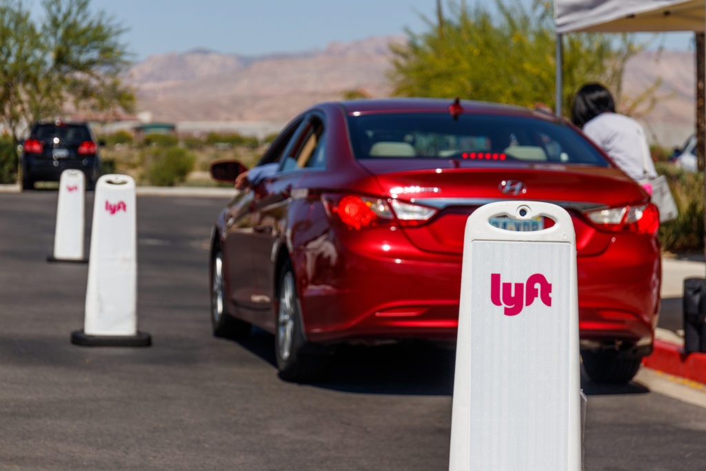
Uber and Lyft are ubiquitous, but you can also hail a ride through LADOT’s on-demand shared-ride service, LAnow. There are also shuttle services, limos, and private vans available.
Taxi Cabs
Nine taxi companies, including LA Yellow Cab, Bell Cab, and United Independent Taxi, operate more than 2,300 taxis. RideYellow and Curb are like rideshare apps but for cabs.
Los Angeles public transportation
Los Angeles public transportation is run by LA County Metropolitan Transportation Authority, but most people refer to it as the LA MTA or Metro. Between bus, light rail, and subway services, LA has the third-largest public transportation agency in the country, providing an average of over a million trips a weekday within the city as well as to neighboring counties and suburbs.
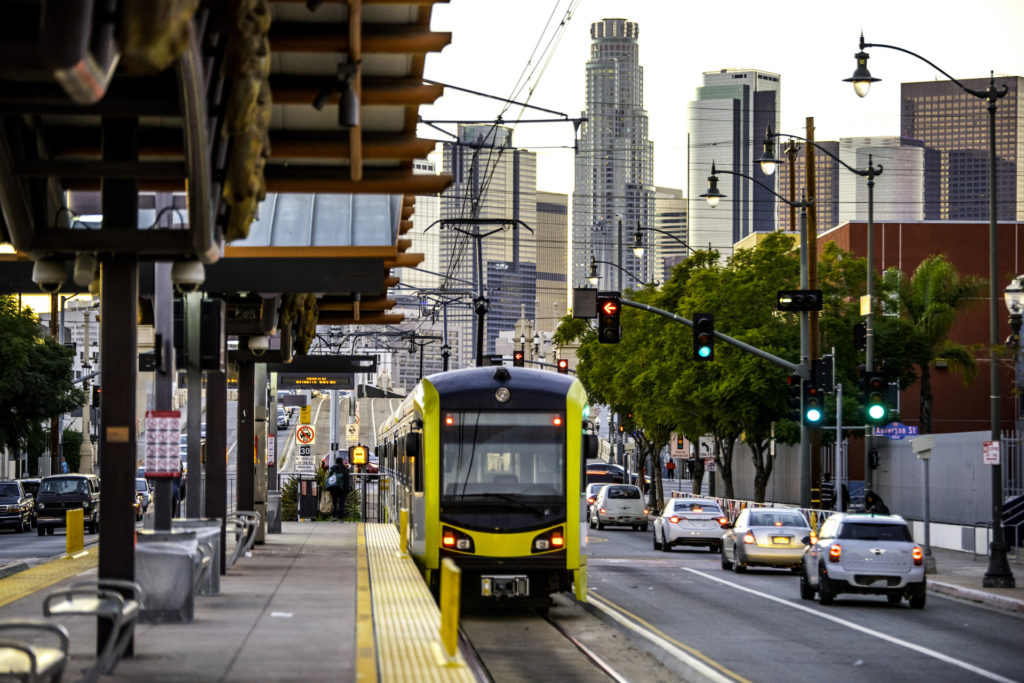
Light rail and subway transportation in Los Angeles
Six LA MTA rail lines connect the areas of Los Angeles County:
- A (Blue Line): North to Downtown LA, south to Long Beach
- B (Red Line): South/east to Union Station (major regional train station for Amtrak, Metrolink and Metro Rail), north/west to North Hollywood
- C (Green Line): Light rail operates mostly in the median of the Century Freeway (Interstate 105). Runs east to Norwalk, west to Redondo Beach.
- D (Purple Line): Subway line running east to Union Station, west to Wilshire/Western in Koreatown
- E (Expo Line): East to Downtown LA, west to Santa Monica
- L (Gold Line): North to Azusa through Pasadena and Highland Park, south to East Los Angeles. Portions run elevated, below ground, in city streets, and in the median of a freeway.
Each of the 93 stations offers connections to the Metro bus system and also with the Metrolink commuter rail system. Use the Metro Rail & Busway Map and/or Metro Trip Planner to help find your way.
A one-way fare on the Metro is $1.75 and is good for two hours of unlimited transfers in one direction. Purchase a Transit Access Pass, or TAP reloadable fare card at any rail station. Refill them at stations, online, or call 1-866-TAPTOGO. If you already have a TAP card, you can refill it on the bus with cash. Regular riders buy unlimited passes for the day, week, or month, but they can only be used on Metro trains and buses. A TAP card can be used with other local transit agencies, like DASH, Big Blue Bus, and Long Beach Transit. Sometimes it can even be used to transfer between two agencies. Metro’s fare inspectors use a handheld unit to randomly check to make sure TAP card users have paid.
Bus transportation in Los Angeles
What the light rail and subway lines don’t cover, Metro’s extensive network of over 165 bus routes do. Over a million passengers take the bus on any given weekday. Metro’s public transportation fleet offers local, rapid, and express services.
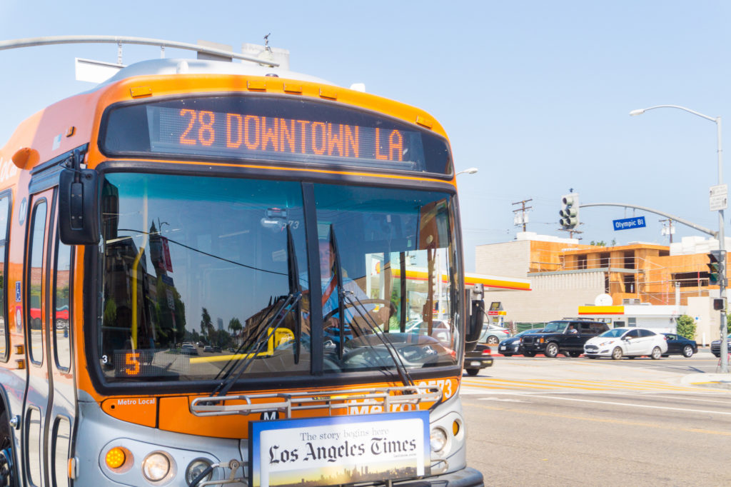
Local buses are painted orange and stop every couple of blocks. Metro buses going to/from downtown are numbered 1-99. Orange buses numbered in the 300s are limited local routes that only run during peak commuting hours.
Rapid buses are faster because they only stop at major intersections. Rapid buses are red and their route numbers are in the 700s. The Metro G (Orange) Line and J (Silver) Line are bus rapid transit (BRT) lines that run on dedicated busways with stops and frequency similar to those of light rail. The Orange Line runs from Warner Center/Woodland Hills to the North Hollywood Red Line station, while the Silver Line travels along Interstate 10 and Interstate 110 to/from El Monte, East Los Angeles, South Los Angeles, Harbor Gateway, and San Pedro.
Express bus routes go longer distances on freeways with fewer stops and a higher premium. Express buses are blue and have numbers in the 400s.
Regular fare is $1.75 and can be paid using exact change or a TAP card. Like the train, bus fares include two hours of unlimited transfers in one direction. Bus routes intersect with LADOT’s DASH buses, Commuter Express, and Santa Monica’s Big Blue Bus.
Intercity bus travel
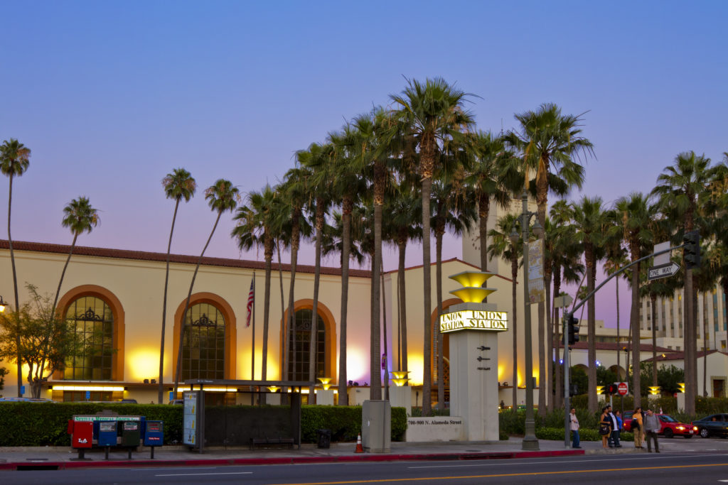
Take the Megabus from Union Station to San Francisco or Las Vegas. Greyhound has a major bus terminal on Seventh and Alameda at the edge of Skid Row, an area predominantly inhabited by the homeless community. Greyhound goes to Bakersfield, which connects to the California Central Valley, San Diego, Las Vegas, and the San Francisco Bay area. Find them all at Union Station in Downtown LA.
Travel by train
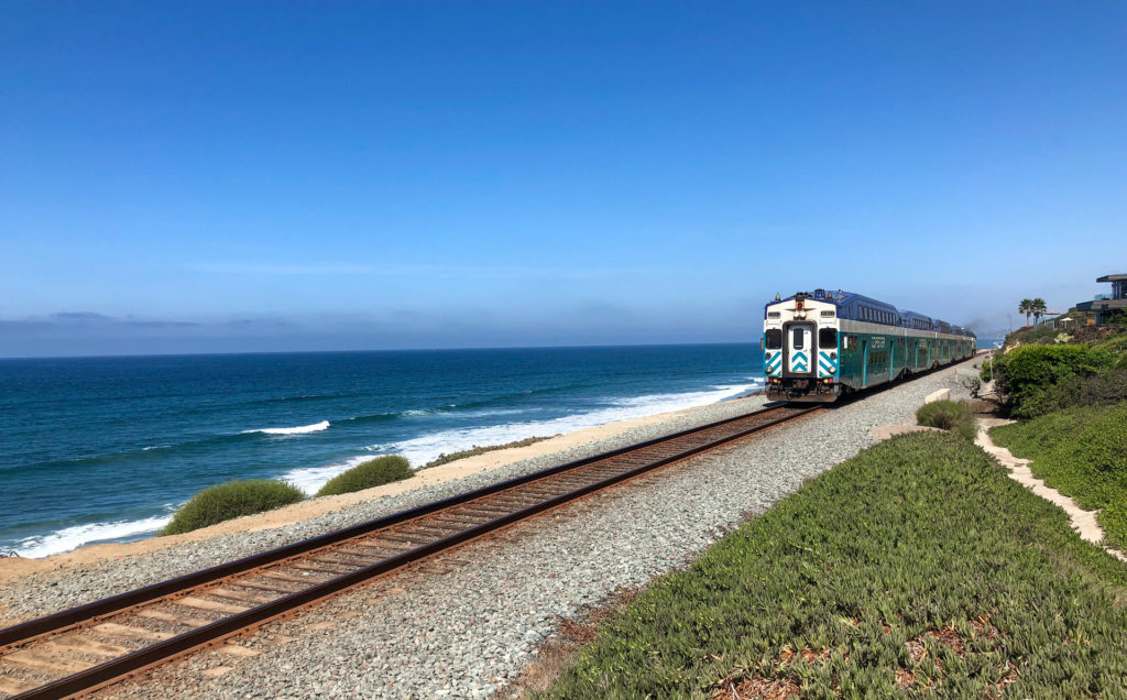
Los Angeles commuter trains
Metrolink provides regional commuter rail service from the surrounding areas of Lancaster, the Inland Empire, Oceanside, Perris Valley, Riverside, San Bernardino, and Ventura County to LA.
Amtrak train travel from Los Angeles
Amtrak has several SoCal stations, but Union Station is one of its busiest, with four lines running as far as Seattle, New Orleans, and Chicago. Amtrak’s Pacific Surfliner travels up and down the LOSSAN Corridor, a busy 351-mile intercity rail corridor that runs along the coast of SoCal between San Diego and San Luis Obispo with stops in Glendale, Burbank Airport, Chatsworth, and Van Nuys.
Los Angeles sky transportation
Airports
The Los Angeles area is serviced by two major airports and several minor airports.
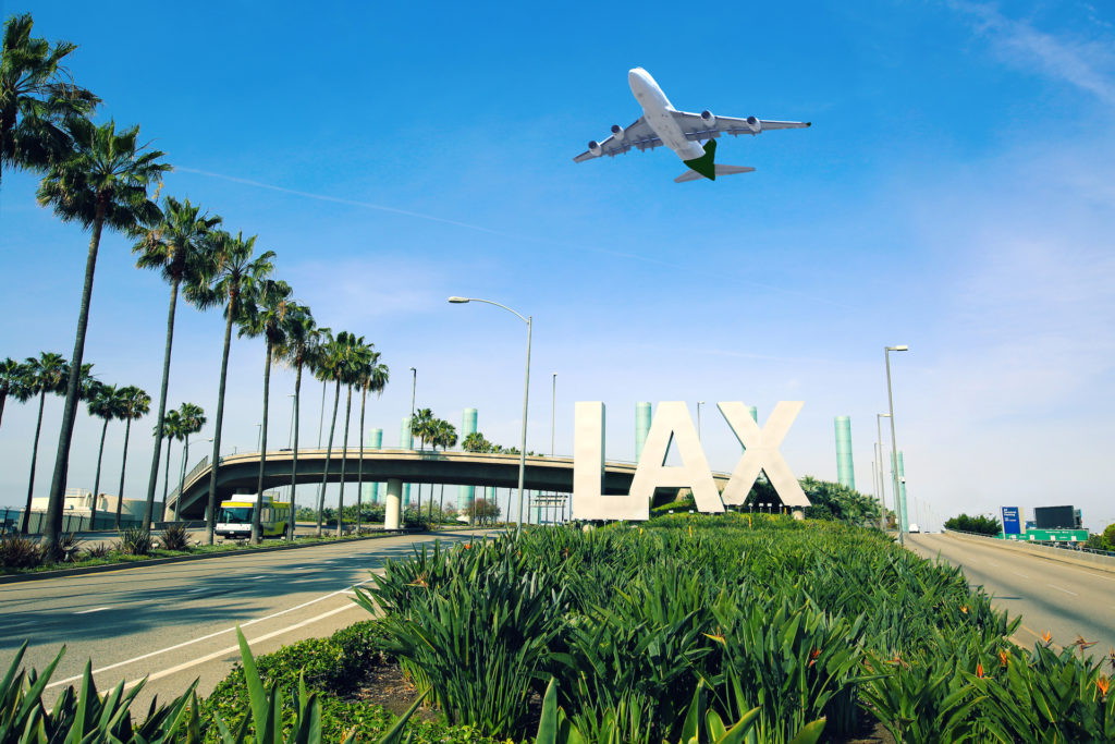
LAX: The Los Angeles International Airport (LAX) is the city’s main international and domestic airport. This commercial airport is the third busiest commercial hub in the US and seventh busiest in the world.
Burbank: Formerly known as Bob Hope Airport, Hollywood Burbank Airport sits a few miles northwest of downtown Burbank. Serving the San Fernando and San Gabriel Valleys, the Burbank airport is closer than LAX to several parts of the city, including Griffith Park, Hollywood, and Downtown.
Public transportation is available to/from both airports. John Wayne Airport services the Orange County area and the Van Nuys Airport services the North LA area.
Alternative transportation options
Walking
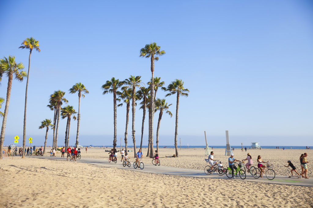
LA boasts over 9,000 miles of sidewalk. West Hollywood is a lively neighborhood of bars and restaurants within walking distance. MacArther Park is also a great choice to walk to stores and coffee shops as you take in the serenity of the beautiful views. Downtown Los Angeles has escalators and skyways like the Bunker Hill Steps for pedestrians. Or you can hit the beach and walk the infamous Santa Monica Pier to take in the vibes of the coast.
Biking
Los Angeles offers beautiful scenery and pleasant weather for biking. There are several bicycle paths, including the Los Angeles River Trail, that are great options. Scenic rides include Griffith Park and the 22-mile coastline-hugging Marvin Braude Bike Trail. Consider taking your bike to some of the city’s famous hikes and see the views on two wheels.
Social Bicycles offers smart bikes for use in Santa Monica, West Hollywood, Beverly Hills, and at UCLA. Metro Bike Share is the best way to get around Downtown, but it also has hubs in the Port of LA and Venice. Bonus: You can register your Metro TAP card to pay for rides.
Scooters
Scooters are taking over the city and can be found on the Westside, in Hollywood, Koreatown, and Downtown. Scope out the Scooter Map to find a scooter near you. Download the appropriate app, like Lime, Bird, Spin, Razor, Uber, Lyft, ou Transit to locate, unlock, and pay for your rides. It’s a dollar or two per ride, with additional fees based on how long your trip takes. Use the bike lane and pay attention to the “no-drop zones” on the app so you don’t leave your scooter somewhere you’re not supposed to.
Ferry
Take the Catalina Express from LA’s San Pedro community for a day getaway to Avalon on Santa Catalina Island.
There are many options for getting around Los Angeles, but the best way to avoid rush hour and travel delays is to choose your neighborhood based on your commute. Utilize the many transportation options available to you to maximize your time as you take in all that Los Angeles has to offer.
While LA might not be the most fun place to drive your car, its various transportation options have you covered. Search thousands of Los Angeles apartments on Zumper and find your next home.
Contenu associé