The Big Apple is the most populous city in America, but since eight million cars won’t fit on the island of Manhattan, the city depends on its vast and efficient transportation system. It’s no surprise that the city that never sleeps has 24/7 transit. Between the subway, the bus, and the occasional Uber, you’ll be covered once you move here. Read on to find out everything you need to know about getting around NYC like a native.
From the Airport
NYC has three major airports. Here’s how to get to Manhattan from each:
JFK: It’s about $50 to take a cab to Manhattan, so we recommend taking the train, which is much cheaper. It takes about 40 minutes to take the Airtrain to Jamaica Center then hop onto the E train towards the World Trade Center. The fastest way is by Long Island Rail Road (LIRR). Once you take the Airtrain to Jamaica Center, purchase a train ticket to Penn Station.
La Guardia: Uber or taxi takes just 20 minutes.
Newark: Take New Jersey Transit to Penn Station.
MTA Subway
NYC has the largest public transportation fleet in the world. The subway shuffles over a billion New Yorkers and tourists around the city each year. Over five million people take trains through underground tunnels and elevated structures to the boroughs of Manhattan, Brooklyn, Queens, and the Bronx each day. (Staten Island has its own separate train system, called the Staten Island Railway.) Trains that travel to Manhattan are Manhattan-bound trains, trains that travel to Brooklyn are Brooklyn-bound trains, etc. This vast and complex system can be intimidating but after a couple of rides, you’ll find that the subway is the fastest, most convenient, and cheapest way to get around the city.
Taking the Subway in NYC
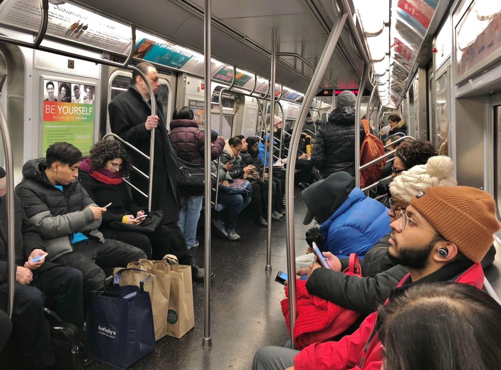
First, download the subway system map and find the route you want to take. Then, look for the train numbers or letters below the name of the station. A station with a white dot means that both the local and express trains stop at this station, while a black dot indicates that only local trains stop there. Pay attention, because some train services, such as the 6 or 7, can either be express or local depending on the time and direction of travel. You may notice that some stations are joined by a black line—this indicates a physical passageway (usually a tunnel) between the two stations, which means you do not have to exit or swipe your MetroCard® again.
MetroCard®, the MTA’s fare payment system, can also be used on MTA Bus, Nassau Inter-County Express (NICE) bus, and on the PATH system. It only costs a few bucks, whether you’re getting off at the next stop or all the way at the end of the line. People who frequent public transport prefer to buy an unlimited monthly pass, but you can also just buy a one-way ticket. Physical MetroCards will be replaced by the Tap-and-Go OMNY (One Metro New York) contactless payment system by 2023.
Nearly all of New York’s subway system is open 24 hours a day. Trains come very frequently, especially on weekdays. Simply find your station and platform and wait for the next train. The MTA trip planner’s routes are sorted by fastest, fewest transfers, and the least amount of walking. Leave early and plan for delays.
Buses
MTA is also in charge of the city bus system, commuter rail lines, bridges and tunnels, and the Staten Island Railway. New York City’s public bus fleet runs 24/7 and is the largest in North America. The Port Authority Bus Terminal is the busiest bus station in the world. According to the Metropolitan Transportation Authority, its NYC Transit buses run in all five boroughs, on more than 200 local and 60 express routes.
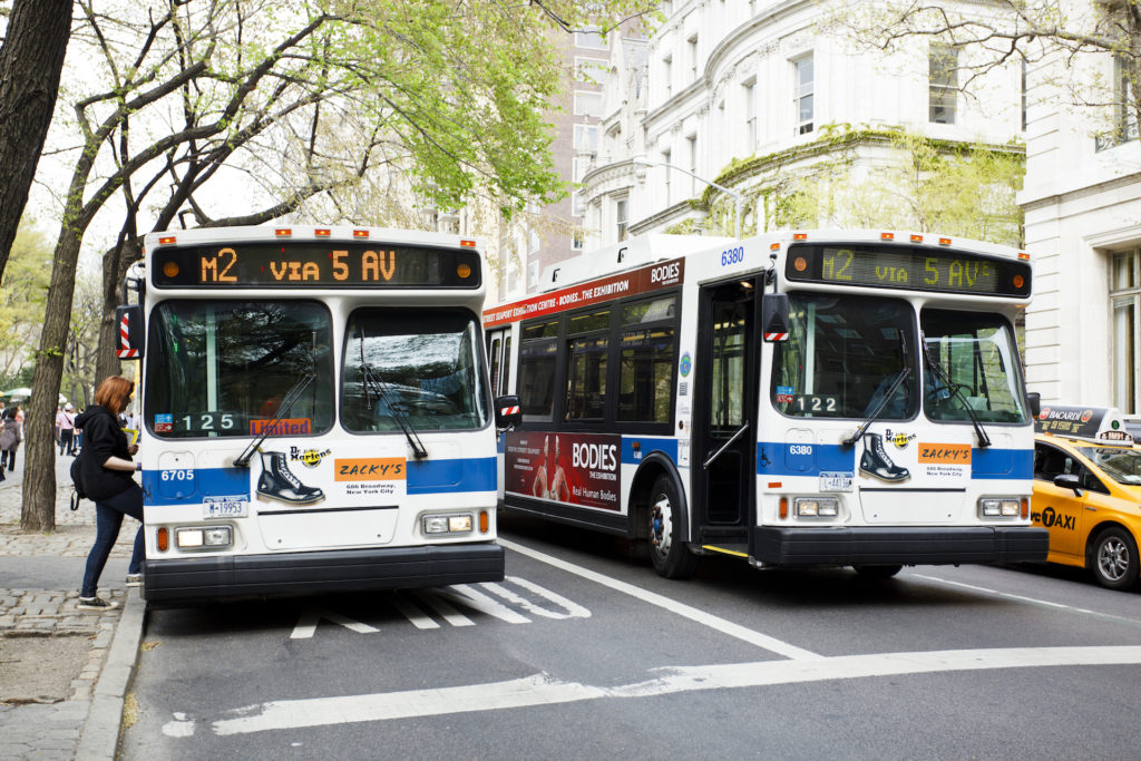
Local bus routes are labeled with a letter that indicates the borough (B for Brooklyn, Bx for the Bronx, M for Manhattan, Q for Queens, and S for Staten Island) and a route number. Express routes are indicated with the letter M at the end, so the Staten Island Express Bus Service to Manhattan via Lincoln Tunnel starts with SIM. Most express buses only run on weekdays during rush hour. Each bus stop has a QR code you can scan to find out what time the next bus will arrive.
At the time of this writing, bus fare is $2.75 and can be paid with a MetroCard or exact change (no dollar bills or pennies). If you use your MetroCard, you get a free bus-to-subway transfer to use within two hours. An Unlimited Ride MetroCard includes all transfers free of charge, but you can’t use it on Express buses unless you purchase a 7-day Express Bus Plus MetroCard. If you pay with coins, you can ask the bus driver for a transfer when you pay your fare and they’ll give you a single-use MetroCard for a free transfer between buses with intersecting routes.
In addition to city buses, there’s also the Jitney, which runs from Manhattan to the Hamptons daily, year-round. The aforementioned Nassau Inter-County Express (NICE) bus is a local bus system that serves Long Island’s Nassau and Suffolk Counties as well as eastern portions of Queens.
Commuter Rail Network
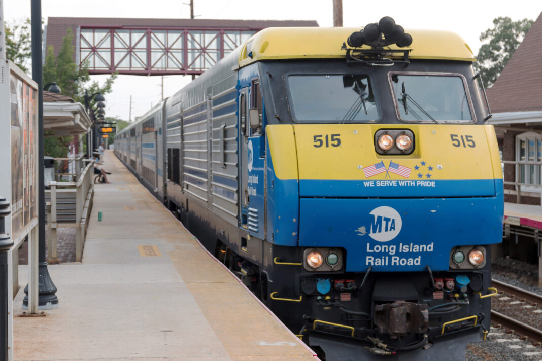
Need to get to the ‘burbs? With more than 250 stations and 20 rail lines, NYC’s commuter rail system is the most extensive in the country. The Long Island Rail Road (LIRR) takes commuters out to…you guessed it, Long Island. The Metro-North Railroad’s main lines run north from Grand Central station to the suburbs of NYC and Connecticut, while west of the Hudson, the Metro North Railroad’s Port Jervis and Pascack Valley lines provide service out to Jersey from New Jersey Transit’s Hoboken terminal. PATH, which stands for Port Authority Trans-Hudson, also connects New Jersey with New York.
The combined systems converge at Grand Central Terminal and Pennsylvania Station. More commonly known as Penn Station, you can find this bustling intercity railroad station inside Pennsylvania Plaza between Seventh and Eighth Avenues in Chelsea on the edge of Midtown. In addition to the New Jersey Transit and the Long Island Railroad, Penn Station serves the subway system and Amtrak.
Amtrak to NYC
Get out of town with Amtrak. Philly, DC, and Boston are all quick trips, while overnight trains connect NYC to Chicago, Atlanta, New Orleans, and Miami. Take Amtrak south to Charlotte or Savannah, or north to Toronto or Montreal.
Ferry to NYC
The Staten Island Ferry is the busiest ferry in the US, providing free, 24/7 service between Whitehall Ferry Terminal in Manhattan and St. George on Staten Island. No cars are allowed on the ferry since 9/11, but you can bring a bike. The ride lasts about 25 minutes and is a favorite with tourists who want to ogle the Lower Manhattan skyline and the Statue of Liberty. Additionally, the NYC Ferry provides service to Manhattan, Brooklyn, Queens, and the Bronx along the East River for the same cost as a subway ride.
Taxi Cabs
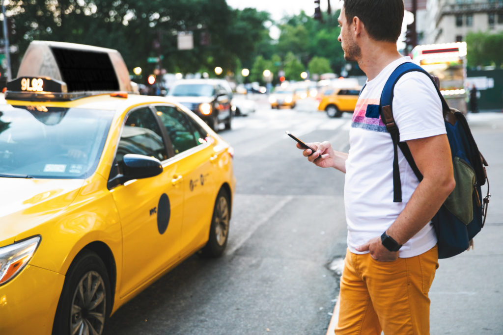
If you simply must take four wheels, then a taxi or rideshare is the way to go. There are cabs everywhere. Green cabs are a for-hire service that you must have pre-arranged—you can’t just hail them (unless you’re above West 110th St and East 96th St or in the outer boroughs), but otherwise, it’s $2.50 just to get in the cab at which point they start quartering (instead of nickel and diming) you. It’s 50 cents for every fifth of a mile, 50 cents for every minute the taxi goes under 12 mph, another 50 cents if your trip occurs between the hours of 8pm and 6am, and another dollar if it’s between 4-8pm on a weekday. You can see why most New Yorkers take the train instead.
Rideshare Apps
In addition to Uber and Lyft, NYC has another ridesharing service called Via.
Walk
New York is the most walkable city in the country and thanks to its rectangular street grid, it’s pretty easy to navigate, too. Avenues run north/south, while streets run east/west. Street numbers increase as you go north and west. Manhattan is divided into a few geographic regions: Uptown (north of 59th St), Midtown (between 59th St. and 14th St), and Downtown (south of 14th St). Uptown and downtown can also refer to which way you’re headed. If you’re going north towards Central Park you are going “uptown.” Going south towards the World Trade Center is referred to as heading “downtown”. “Crosstown” means east/west. Long blocks, or east/west blocks, are also referred to as crosstown blocks. North/south blocks along avenues are called short blocks.
Bike
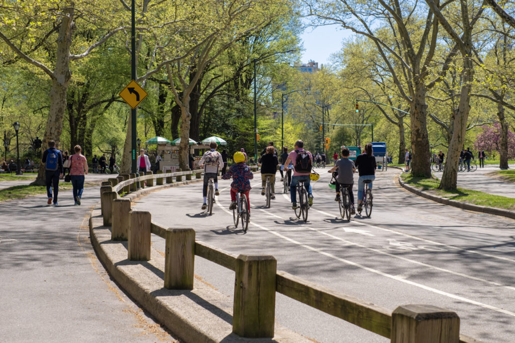
Biking is another great way to get around, although NYC is not known as the most bike-friendly spot, with its potholes, bike lanes that get blocked by delivery trucks and parked cars, and a plethora of pedestrians. Plus, the NYPD is notorious for ticketing bicyclists to meet quotas. Nevertheless, commuters, delivery and messenger services (utility cyclists), and recreational cycling clubs take to the streets on two wheels. A membership to Citi Bike, the city’s bike-share system, is $169/year, or you can pay by the ride or by the day. Just download the app and pick up a bike at one of the hundreds of stations around Manhattan, Brooklyn, Queens, the Bronx, and Jersey City. Pro tip: Don’t lock your bike to scaffolding, which can be easily disassembled by thieves.
Best NYC Boroughs for Public Transportation
Finding the right New York neighborhood to call home is important—as it will inevitably become part of your New York identity—but getting a place near public transportation is a must. The further out you go (think: Brooklyn, Queens, and the Bronx), the more affordable accommodations become.
Brooklyn and Queens are located at the west end of the larger Long Island. Most Brooklyn neighborhoods are easily accessible by the C subway line. Queens is the largest borough by square miles, but despite its size, it’s very convenient to get in and out of Manhattan—sometimes without even changing trains.
Ready to put all this information to use? Search thousands of NYC apartments on Zumper and find the one that’s right for you (or the one that’s nearest to a subway line).
Contenu associé


